Custom software
IrriDesign Pro
A design and documentation platform for irrigation designers. Layout, hydraulics, power sizing and the client pack all live on one satellite map instead of across three tools.
The problem
Designing a pivot layout is the quick part. What eats the week is everything after it: transferring the layout into a hydraulic model, sizing the pump and generator in a spreadsheet, checking application rate against soil intake by hand, then rebuilding the client pack from scratch every time a span or a valve moves. Checking somebody else’s finished design meant re-deriving numbers that had already been calculated once.
What we built
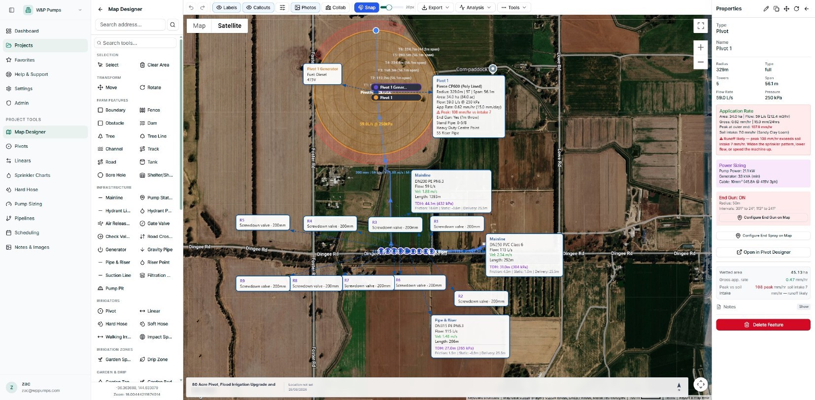
IrriDesign Pro puts the design on a satellite map and keeps the analysis attached to it. Pivots, linears, hard hose, mainlines, risers, valves, pump stations and boundaries are drawn straight onto the property. Hydraulics solve against the actual layout, so every mainline carries its own flow, velocity, friction and TDH, and every pivot carries its span, tower count, flow and pressure. The system flags what a spreadsheet cannot: peak application rate against soil intake, runoff risk, end gun coverage, pump and generator sizing. Change a span and the numbers, the warnings and the exported pack all move with it.
The result
The design, the hydraulics and the documentation stop being three separate jobs. Reviewing a completed design becomes a matter of opening it rather than rebuilding it.